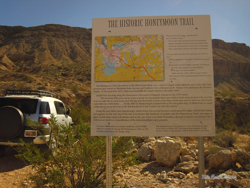
Honeymoon Trail
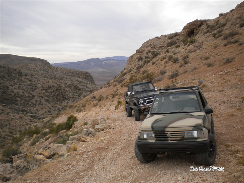
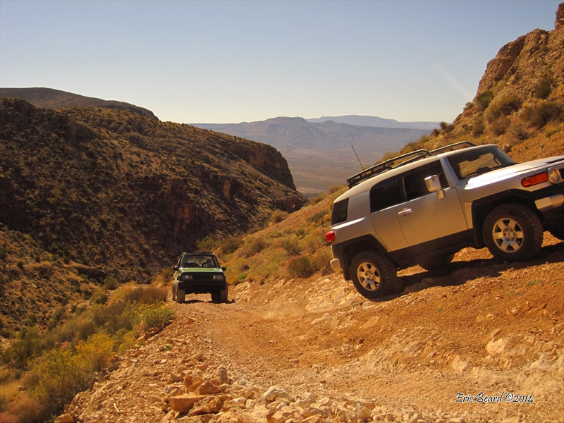
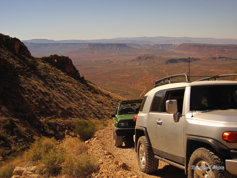
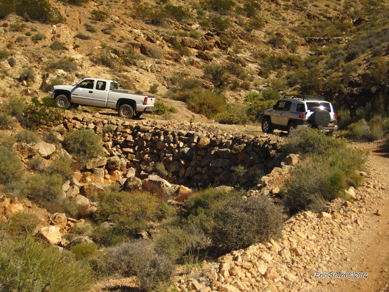
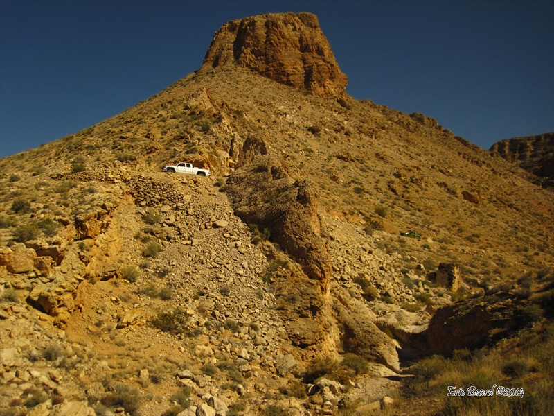
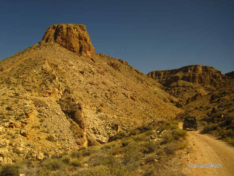
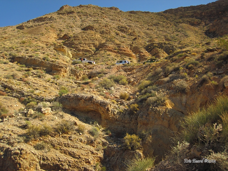
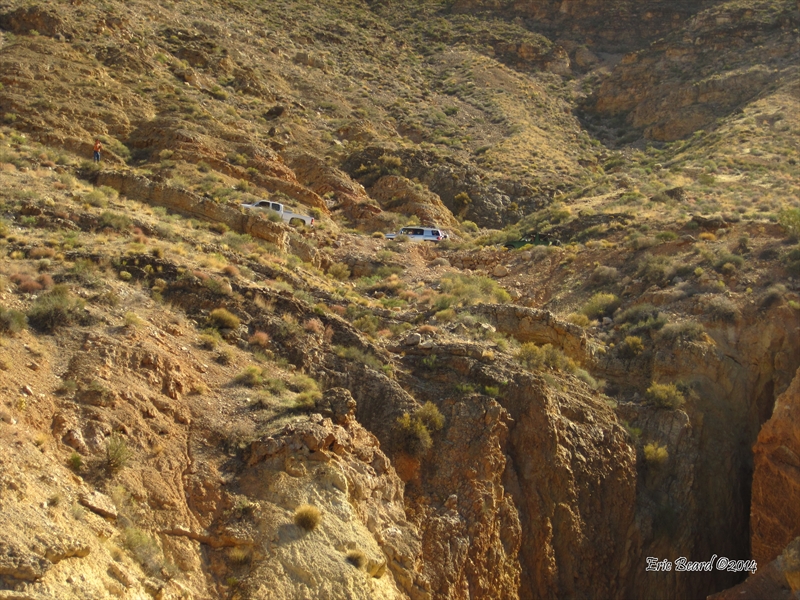
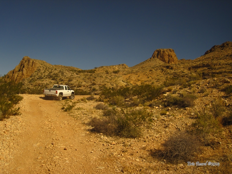
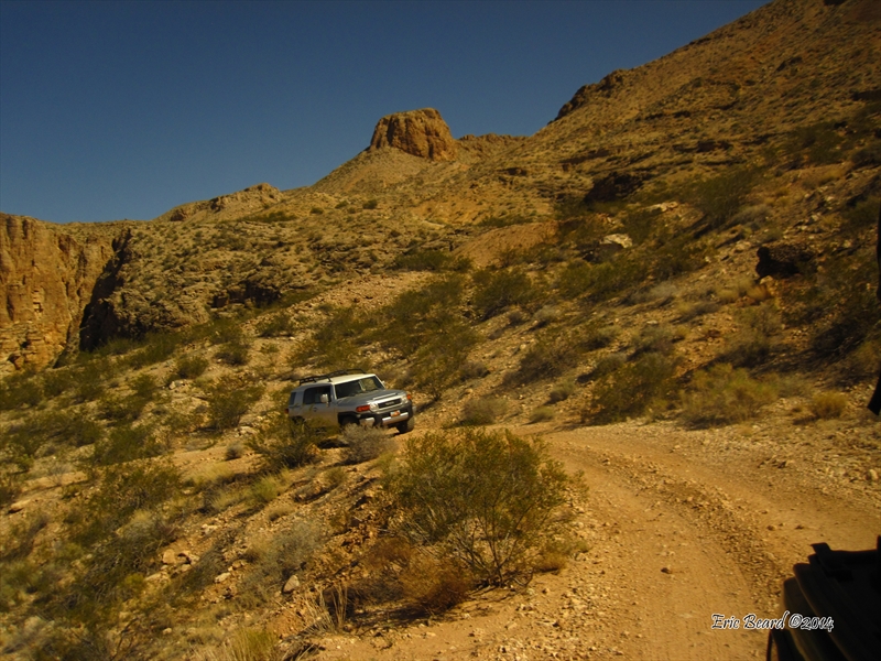
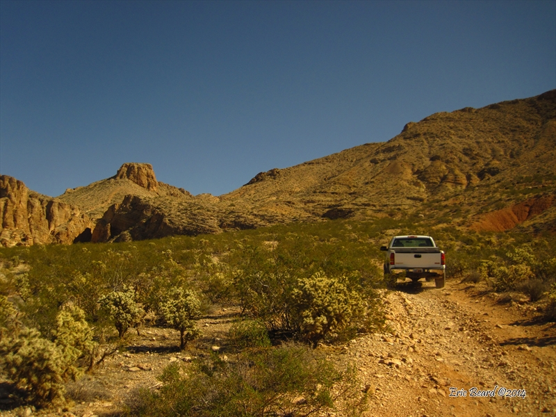
This is a fabulous trip to the top of the Hurricane Cliffs with views for miles. This 3 rated trail climbs the old Honeymoon Trail that pioneers took to get married at the St. George Temple from as far away as Arizona, and was one of the first wagon trails down the cliff. There are many sections of hand-stacked rocks supporting the road surface, and there are some stretches where you can see original trail paths. The views from the top are spectacular as you run along the cliff edge and overlook Sand Hollow Reservoir and Sand Dunes and turn around and look straight up Zion Canyon. This is the best trail for overlook views of the entire St George, Hurricane, and Zion areas.
Scenery
The trail starts south of the city of Hurricane along the base of the Hurricane Cliffs, then climbs up to the top via a couple of scenic canyons where the ruins of rock retaining walls are visible beneath the original route. On top, there are pastoral farmlands as the route turns north along the top of the cliffs. Before returning to Hurricane City, the route diverts to an interesting rock formation named "Molly's Nipple." From Wikipedia: "Sources claim there are eleven geological features in Utah that bear this name. At least some of those names are attributed to John Kitchen – a pioneer of an early exploration of Utah, who named them to commemorate his wife (or his bride according to some sources) Molly.
Surface
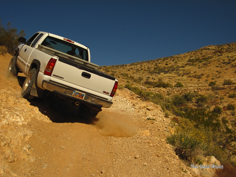
Two-track wagon road with several eroded ledgy areas that are a bit off camber.
Trail Details
This scenic drive will take you along the old wagon road along the base and upper edges of the towering sandstone cliffs. There is a steep climb up to to the foot of the cliffs, then a rocky road that winds its way up two canyons in the Hurricane Cliffs. Just before the top of the climb, there is an off-camber section with a couple of small ledges to climb before reaching the top. The route from the top is mostly two-wheel drive, unless there has been recent inclement weather, which may create muddy conditions.
Trail Rating

Trail Notes
Length: 55.3 total, 14 miles on pavementMin Tire Size: stock
Winch: No
Front Locker: No
Rear Locker: No
Trail Gallery


.JPG)